Friday, October 28, 2011
Sarah's Trip to the Granada Theater!
My name is Kelly Ellis. On October 28, 2011 around 11:00 a.m. Sarah and I, along with two of my children drove in a car to the Granada Theater located at 106 N. 9th street in Mount Vernon, Illinois. According to my Tom Tom, G.P.S. navigational system the latitude is 88 degrees 54.156 W and the longitude 38 degrees 19.075 N. Sarah traveled 59.60 miles and that took one hour and ten minutes.
The Granada Theater was built in 1937 by the Boller brothers. It was the first theater in Mount Vernon to have air conditioning. It began as a theater then in the 1970's it was used as office space. It was again used as a theater in the 1980's and I saw many movies there as a pre-teen and teenager.
Now the Granada Center for the Performing Arts is working on restoring the building to it original beauty. It can be rented for public and private functions. The money goes toward the restoration project. For more information copy and paste this site,
http://www.granada.mvn.net/Facility%20Rental%20Information.html
Occasionally a family friendly movie will be played at the theater for no charge. This is a good time for families to go enjoy a night out with no additional costs. The have played "It's A Wonderful Life" and recently the showed the animated film "Shrek".
Wednesday, October 26, 2011
Sarah's trip to Garden of the Gods
On Oct 2nd, Sarah and I decided to go for a hike at the Garden of the Gods located near Herod IL. The Garden of the Gods in located in southern Illinois in the Shawnee National Forest. The wilderness area is over 320 million years old and covers over 3,300 acres of beautiful forest. The sediment rock in this area is over 4 miles deep and the fractured bedrock and created various rock formations. Sarah and I observed many rock formations and wildlife. The rock formations included: Camel Rock, Turtle Rock, and Knights of the Round Table. We traveled to Garden of the Gods by car and it took us over an hour to reach our destination. The trip from Wham to Garden of the Gods was over 60 miles. The latitude and longitude coordinates were 37.609880 - 88.387985. Sarah behaved well for me, but I didn't let her stray very far for the high cliffs can be dangerous.
Tuesday, October 25, 2011
Frank Learns About Coal Mining in Southern Illinois!
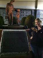
Hello! My name is Kara Stark, and Frank and I spent some quality time cruising around good, 'ole, Southern Illinois! After jamming out to some awesome 90's tunes in the Escort, we decided to make a stop in Herrin, IL, where we observed the Coal Miner's Memorial. We had a little trouble finding it at first. Frank finally decided to stop and ask for directions, and we were able to find it. It was hidden away on the corner of 14th Street and E. Cherry. It was only 16.12 miles (37.803574 latitude, -89.026445 longitude for the map readers out there), but it sure seemed to take all day! After we got out to explore, we were overwhelmed with how many names there were. Frank and I first stopped to read the inscription at the base of the statue, which read, "In memory of coal miners who gave so much that future generations may benefit with a better life. They labored, served their country, sacrificed for their families and some lost their lives. We honor and salute them so that they will never be forgotten." We learned that the monument, dedicated on October 14th, 2000 (my birthday!), depicts a miner returning home and being greeted by his son. We also learned that Southern Illinois used to be a huge coal mining community. In fact, it was the reason that many of the towns in southern Illinois were created! Coal was even called "black gold". As Frank pointed out, it was amazing to see how many names were around the Memorial. It sure is something to know that that many lives were impacted by the coal mining industry. We tried to stay and read all of the dedications, but it was past Frank's bedtime, so we had to make the trip back. It was definitely an interesting trip, and I hope that we can go back, soon!
Sarah visits Capaha Park
Hello, my name is Brandi Baldi. Sarah and I took time this weekend to visit Capaha Park in Cape Girardeau, Missouri. This is located at 37.3125506 latitude and -89.5370368 longitude. Capaha Park was home to the Capaha tribe during DeSoto's expedition. In 1792, Louis Lorimier was sent from Spain as an ambassador of Indian relations.
At the entrance of the park are several memorials placed there to remember members of the community which have died while serving our country. Sarah, my daughter Lily, and myself took a minute reading all the names of those who defended our country so bravely. A replica of the Statue of Liberty is also present near the memorials. Sarah enjoyed all the beautiful flowers which had been planted in the area to make it more appealing.
After we had spent our time exploring the park and Sarah running through the hills, we were invited to take part in the Southeast Missouri State University homecoming parade as part of the campaign efforts of my sister-in-law, Holly Rehder, who is running for Missouri state House of Representatives. Sarah was tired after running through the park so she was allowed to ride along in my nephew's stroller while my daughter pushed. My nephew, Kaydin was happy to share his suckers with Sarah as the crowds of people cheered for our group of walkers. After the parade, my sister-in-law invited Sarah and I to have our picture taken with her to help complete our expedition.
We really enjoyed our time in Cape Girardeau and at Capaha Park. We had planned on visiting the Lorimier Cemetary but it was not open at the time we were visiting. However, Cape has many historical sites which Sarah and I agreed would call for another visit soon to this riverside town.
Friday, October 21, 2011
The Dogwood Tree
Hello, my name is Rob Robinson. Sara and I took a trip through the country to see the largest Dogwood tree in the state of Illinois. The tree is located at the Union Chapel Cemetery in Texico, Illinois. Latitude 38 Degrees North and 88 Degrees West. The first burial at this cemetery was December 29, 1895. It is unknown the exact date the tree was planted but would guess as the dates provide a timeline between 1895 and 1914, more likely between 1896 and 1913 either way the tree would be at least 100 years old.
The tree was planted by Rebecca Green she was born September 26, 1846 and died January 8, 1914 she is buried at Union Chapel Cemetery. In the 1900 Census Rebecca Green was living in Field Township with her husband Francis M. Green and seven children. According to the IL Statewide marriage index Rebecca Clark and Francis M. Green were married May 7, 1884 in Jefferson County, IL.In the 1880 Census Rebecca Clark is living in Field Township as the head of household with two sons ages 6 and 5.The IL Statewide marriage index shows a Vestal A. Clark was married to Rebecca Penacuff on June 5, 1874.
At first Sara and I thought that this would be kind of silly to adventure, but we are both glad that we went. When we first arrived to the cemetery, we both knew exactly which tree it was, it was just there by itself and even thought it was not in bloom you knew that it was the tree. Sara and I both felt that the tree gave the place a peaceful and calming feel. You kind of knew that God has used his creation to give peace to the families that have lost someone that is buried there. Overall, Sara and I enjoyed our time together.
Tuesday, October 18, 2011
Sarah visits army tank
My name is Sarah Speraneo and I took the Sarah home with me for a week. On October 18th, Sarah and I braved the freezing cold rain to travel by car 17.88 miles to visit the VFW's army tank. The army tank is located at the Veteran of Foreign Wars building in Marion Illinois at latitude 37.75 and longitude -88.93. The tank is an actual tank recoverd from a foreign war (unknown which one) and available for viewing to the public. This would be interesting to take a class to and show them what type of tanks were used in foregin wars. Students of all grades would enjoy the trip because they could physically see the tank as well as experience being close to it, touch it, take a picture with it, which most students would find an army tank just "so totally cool!" The main uses for tanks in a war were for protection, to carry weapons, and to move from place to place. Tank development has consisted of making changes in order to improve protection, mobility and firepower. Improvements to engines and suspensions enable tanks to move faster over rough terrain. Tank armament is constantly being upgraded; tank weapons have ranged from machine guns to missile launchers.
Sunday, October 16, 2011
Frank's Gateway Arch Experience
Hi, my name is Amanda Long! When Frank received the opportunity to come home with me I was unsure where we should go. I told Frank that my boyfriend and I had to go to Fairview Heights, IL to pick up a bridesmaid dress this weekend. I didn’t want to be rude, so I told him he could come along and we could go on some historic adventure. Frank said he didn’t want to be a 3rd wheel, but he would really enjoy visiting the Gateway Arch. I haven’t been to the Arch since I was a child, so I told him that was a great idea and he wouldn’t be a 3rd wheel! On October 16, 2011 we traveled a total of 202 miles to the arch and back home to SIUC. The Gateway Arch has the Latitude of 38.624901 and Longitude of -90.186317. Before we left Frank asked me if I knew much about the Gateway Arch, and to be honest I did not. So I told him this would hopefully be a learning experience for the both of us. We drove my car first to pick up my dress, which Frank thought was lovely, than we went to the Arch. At the Arch, we learned that the arch is the nation’s tallest monument, reaching 630 feet tall! The Arch is the centerpiece of the Jefferson National Expansion Memorial in St. Louis, Missouri. There was a nationwide competition in 1947-1948 to design a monument in St. Louis honoring western pioneers. The architect Eero Saarinen (August 20, 1910 - September 1, 1961) won the contest with his sleek arch. Saarinen came up with this idea from Eads Bridge connecting Illinois to Missouri. Frank and I found all of this information out by watching a short video before traveling to the top of the Arch. Frank, my boyfriend, and I were surprised to see the small tram we had to ride to the top in. I think Frank may be a little claustrophobic, but we made it to the top without getting sick or having a panic attack. Frank enjoyed looking out the windows at the top, though he would have preferred the windows to be open so he could stick his head out and feel the air. We rode the tram back down, and traveled back to SIUC. This was a great experience for Frank, my boyfriend, and I. I think I can say we all had a great time!
Wednesday, October 12, 2011
Rebel Frank visits Jefferson County Historical Village
Hello, my name is Regan Parks. Rebel Frank and decided to travel to Jefferson County Historical Village in Mt. Vernon, Illinois on Friday, October 7th, 2011. The Historical Village has the latitude and longitudinal coordinates of 38.332354 and 88.924563. We enjoyed our travels north in my car from SIUC to Mt. Vernon relishing in the emerging fall colors of the season. We traveled a total of 119.08 miles. We decided to stop off at my sister’s home in Woodlawn and share the historical experience with my nieces, Emma (14 years) and Ava (7 years). Jefferson County Historical Village is an authentic representation of buildings and artifacts from the original settlement of Mt. Vernon in the late 19th century. Rebel Frank, Emma, Ava and I especially enjoyed the medical building as showcased medical equipment and tools of the time period. We discussed how technology has changed over time and how many of the diseases like diphtheria which threatened lives of people from that era, is no longer a communicable threat. The general store was appealing as it displayed genuine products of the 19th and 20th century. My favorite building was the little school house that portrayed the look and feeling of the 19th and 20th century educational building. It visually symbolized the original multiage classroom. The Jefferson County Historical Village is an amazing reflection of the past that exemplifies the spirit of the people from the time period and I highly recommend it to anyone interested in learning about the past.
Tuesday, October 11, 2011
Sarah Travels to Orland Park
My name is Stephanie Schofield, today is October 11,2010 and I took Sarah to the Twin Towers Church located in Orland Park Illinois. We began our journey by taking a train to Homewood Illinois and then drove to my hometown of Orland Park. Sarah was kind of restless towards the end of the train ride but made lots of friends on the train. We traveled a total of 638 miles round trip, 37.717764,-89.222193 to 41.628776,-87.862428!
When we were finally finished traveling, we reached The Twin Towers Church in Orland Park, Illinois. The church was originally built in 1898 by Architect William Author Bennet. In 1989, the church was added to the National List of Historic Places. As we walked around the church, the most unique characteristic we saw is the is the two hexagonal towers at opposite corners, one of the only remaining churches in Illinois to have this unique architecture. We also learned that during the 1920's the church was the first place in Orland Park to show silent films. Before we left, Sarah and I took a picture on the steps of the church. After many attempts to take a picture (my dad could not figure out how to work my phone) we decided this was the best picture. We also decided to add another picture so you can better see the beautiful architecture of the church. Sarah and I enjoyed our trip, but after another six hour trip back to Carbondale, are happy to be finished traveling for the day!
Saturday, October 8, 2011
Sarah Goes To See Historic New Harmony, Indiana
My name is Vicki Aud. I decided to show Sarah the town of New Harmony. We left on Friday, September 30, 2011. I know this town very well. I use to work there by cleaning some of the restaurants, homes and rooms at the Inn. My husband, John, and my son, Logan, both wanted to join us on our journey. Sarah traveled 180 miles round trip. The coordinates for the trip are Latitude: N 38.128625 and Longitude: W -87.938965 We drove in my Pontiac G6 to New Harmony and then we walked between sites.
New Harmony is the site of two of America's great utopian communities. The first, Harmonie on the Wabash in 1814, was founded by the Harmony Society, a group of Separatists from the German Lutheran Church. The town was transformed by one of the owners, Robert Owen, buying the land of the other. The town has many Harmonist (1814-1824) buildings and 12 early 19th century buildings and 20 from mid-19th century, Gardens, a reconstructed Harmonist Labyrinth, a museum, library, gallery, Thrall’s Opera House, Murphy Auditorium, Beal House, log cabins, Roofless Church, and a theater. The New Harmony Inn has a Conference Center that offers the comforts of city-living in a rural setting. The town's unique history comes alive on guided tours offered to 15 historic sites which begin at the Atheneum/Visitor Center.
The day was gorgeous with perfect weather. My family decided to walk around New Harmony to various sites. This allowed Sarah to stretch her legs from the long car ride. We began our journey at the New Harmony Inn. I showed everyone where I had formerly worked. Then we visited the Roofless Church, some log cabins, and a garden/labyrinth. Then we walked to the Visitor Center. We took time at the Atheneum/Visitor Center. Sarah ran freely on the huge lawn before entering inside. There is a museum display and educational signs and maps describing the history of New Harmony. We watched a 20 minute film informing us about the history of New Harmony. We learned that world-renowned scientists and educators settled in New Harmony. New Harmony is also the site of the early headquarters of the U.S. Geological Survey and provided the earliest geological and natural science collections for the beginnings of the Smithsonian Institute. From 1830 until 1860 New Harmony was one of the most important training and research centers for the study of geology in America.
Sarah posed for some fun photos to share with everyone and then took a small nap in the sun before the long journey home. We all had a great day together.
URL: http://www.newharmony.org
Subscribe to:
Posts (Atom)